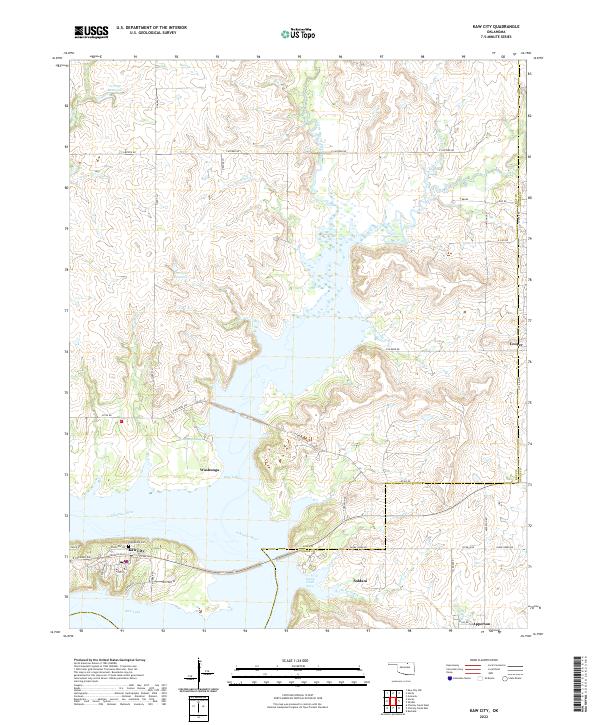
2022 Map of Kaw City
USGS Topo · Published 2022About this map
Kaw Lake dominates this north-central Oklahoma landscape, where the Arkansas River was impounded to create an expansive reservoir system. The modern settlement of Kaw City sits at the southern edge of this water complex, bordered by local landmarks like Grandview Cem. Across the water, the community of Washunga remains a focal point near Washunga Bay, reflecting the regional history of displaced townsites following the mid-20th-century reservoir construction.
Find a feature on this map
51 named features on this map. Tap any name to fly to it.
Don’t see what you’re looking for? This feature index may not catch every label — zoom into the map to look around manually.
Map Details
Editions of this 2022 Kaw City Map
This is the sole edition of this map. No revisions or reprints were ever made.
Other maps of this area

1916 · Foraker
USGS Topo · 1:62,500

1932 · Fairfax
USGS Topo · 1:62,500

1935 · Kaw
USGS Topo · 1:62,500

1936 · Belford
USGS Topo · 1:62,500

1955 · Enid
USGS Topo · 1:250,000

1958 · Enid
USGS Topo · 1:250,000

1963 · Charley Creek
USGS Topo · 1:24,000

1963 · Uncas
USGS Topo · 1:24,000

1963 · Kaw City NW
USGS Topo · 1:24,000

1964 · Charley Creek NE
USGS Topo · 1:24,000