
1935 Map of Kaw
USGS Topo · Published 1935About this map
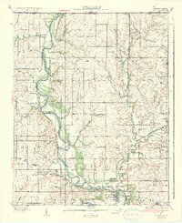
The Arkansas River winds deeply through the borderlands of Kay and Osage Counties in this mid-1930s survey, creating a dramatic landscape defined by sharp meanders like Oxbow Bend. This era reflects a rural society organized around small district schoolhouses, with nearly a dozen named campuses such as Cantwell Sch, Tipton Sch, and Canadian Sch serving the surrounding farming communities. The industrial presence of the region's energy sector is marked by Oil Tanks located near the Santa Fe rail lines, which also connect small trackside settlements like Uncas and Apperson. In the northwestern corner, Chilocco stands near the Kansas border, while the southern reaches feature local landmarks such as Maple Grove Ch and Wildcat Creek. The map provides a detailed view of the early 20th-century road network and the dense system of tributaries, including Beaver Creek and Bear Creek, that feed into the primary river valley.
Find a feature on this map
50 named features on this map. Tap any name to fly to it.
Don’t see what you’re looking for? This feature index may not catch every label — zoom into the map to look around manually.
Map Details
Editions of this 1935 Kaw Map
2 editions found
Other maps of this area

1889 · Burden
USGS Topo · 1:125,000

1890 · Wellington
USGS Topo · 1:125,000

1916 · Foraker
USGS Topo · 1:62,500

1932 · Fairfax
USGS Topo · 1:62,500

1936 · Belford
USGS Topo · 1:62,500

1955 · Wichita
USGS Topo · 1:250,000

1955 · Enid
USGS Topo · 1:250,000

1958 · Enid
USGS Topo · 1:250,000

1958 · Wichita
USGS Topo · 1:250,000

1962 · Dexter SW
USGS Topo · 1:24,000