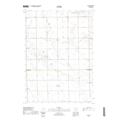
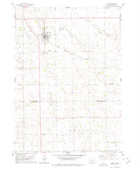
2017 Map of Kaylor
USGS Topo · Published 2017About this map
Kaylor stands as a focal point in this portion of Hutchinson County, where the agricultural landscape is divided by a rigid grid of section line roads like E Section Line Rd. The terrain is shaped by the winding paths of S Br Lonetree Cr and Dawson Cr, which create natural breaks in the cultivated fields. For those researching local family histories, the map identifies several smaller burial sites that reflect the area's rural heritage, including the Emil G Mogck Farm Cem, Simental Cem, and Dennewitz Cem. This document provides a clear view of the township's organization, showing the intersection of local infrastructure and the natural watercourses that have historically supported the farming communities of southern South Dakota.
Find a feature on this map
24 named features on this map. Tap any name to fly to it.
Don’t see what you’re looking for? This feature index may not catch every label — zoom into the map to look around manually.
Map Details
Editions of this 2017 Kaylor Map
This is the sole edition of this map. No revisions or reprints were ever made.
Other maps of this area

1898 · Olivet
USGS Topo · 1:125,000

1955 · Sioux Falls
USGS Topo · 1:250,000

1957 · Tschetter Colony
USGS Topo · 1:24,000

1957 · Scotland
USGS Topo · 1:24,000

1958 · Sioux Falls
USGS Topo · 1:250,000

1978 · Tripp SE
USGS Topo · 1:24,000
1978 · Kloucek Lake
USGS Topo · 1:24,000
1978 · Haucks Lake
USGS Topo · 1:24,000
1978 · Kaylor
USGS Topo · 1:24,000
1978 · Tripp
USGS Topo · 1:24,000