Loading...
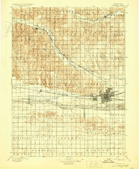
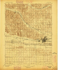
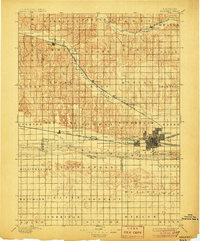
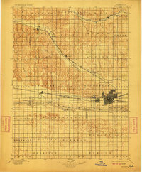
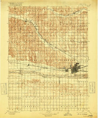
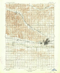
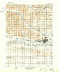
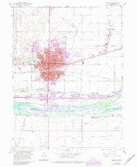
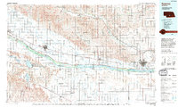
Loading map...1896 Map of Kearney
USGS Topo · Published 1929About this map
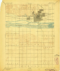
Kearney serves as the focal point of this late 19th-century landscape, positioned where the Union Pacific R.R. and the Burlington and Missouri River R.R. intersect. The era’s industrial and agricultural dependence on water is evident in the complex hydraulics of the Kearney Canal and several nearby lakes, including Kearney Lake, Echo Lake, and Greenwood Lake.
Find a feature on this map
64 named features on this map. Tap any name to fly to it.
Don’t see what you’re looking for? This feature index may not catch every label — zoom into the map to look around manually.
Map Details
Date Portrayed1896
Date Published1929
PublisherU.S. Geological Survey
Map TypeTopographic
Scale1:125,000
Physical Dimensions16.4 x 19.8 inches
Editions of this 1896 Kearney Map
7 editions found
Historical Maps of Kearney Through Time
8 maps found
Featured Locations
Source Details
SourceU.S. Geological Survey
CopyrightPublic Domain