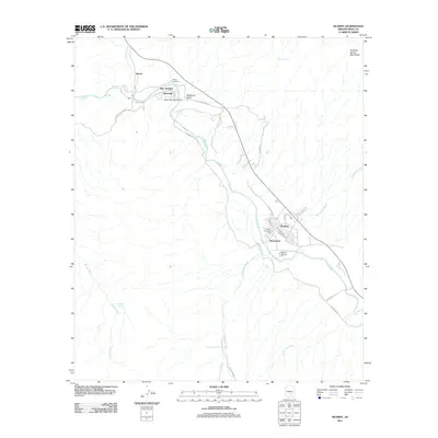
2011 Map of Kearny
USGS Topo · Published 2011About this map
The Gila River corridor near the Dripping Spring Mountains anchors this 2011 survey, showing a landscape defined by desert hydrology and early 21st-century infrastructure. The primary settlement of Kearny is detailed with its modern street grid, including Allen Dr and Hartford Rd, alongside local landmarks like the Kearny Municipal Pool and the Kearny Airport.
Find a feature on this map
35 named features on this map. Tap any name to fly to it.
Don’t see what you’re looking for? This feature index may not catch every label — zoom into the map to look around manually.
Map Details
Editions of this 2011 Kearny Map
This is the sole edition of this map. No revisions or reprints were ever made.
Other maps of this area

1900 · Florence
USGS Topo · 1:125,000

1902 · Florence
USGS Topo · 1:125,000

1910 · Ray
USGS Topo · 1:62,500

1911 · Winkelman
USGS Topo · 1:125,000

1913 · Winkelman
USGS Topo · 1:125,000

1934 · Newman Peak
USGS Topo · 1:125,000

1949 · Crozier Peak
USGS Topo · 1:24,000

1949 · Winkelman
USGS Topo · 1:24,000

1949 · Winkelman
USGS Topo · 1:62,500
1950 · Crozier Peak
USGS Topo · 1:24,000