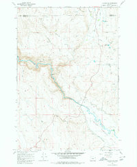
1967 Map of Keating NW
USGS Topo · Published 1980About this map
The Powder River carves a central path through this landscape on the border of Union and Baker Counties, where water management defines the local geography. Significant irrigation infrastructure is evident through the winding paths of the Basche Ditch and Emele Ditch, alongside multiple instances of a Diversion Dam positioned to harness the river's flow. These engineering efforts support the Lower Powder Valley in the southeast, a contrast to the high drainage basins of Big Rattlesnake Creek and Little Rattlesnake Creek to the north.
Find a feature on this map
21 named features on this map. Tap any name to fly to it.
Don’t see what you’re looking for? This feature index may not catch every label — zoom into the map to look around manually.
Map Details
Editions of this 1967 Keating NW Map
2 editions found
Other maps of this area

1901 · Baker City
USGS Topo · 1:125,000

1906 · Telocaset
USGS Topo · 1:125,000

1955 · Baker
USGS Topo · 1:250,000

1955 · Grangeville
USGS Topo · 1:250,000

1959 · Baker
USGS Topo · 1:250,000

1959 · Grangeville
USGS Topo · 1:250,000

1965 · Flagstaff Butte
USGS Topo · 1:24,000

1965 · Medical Springs
USGS Topo · 1:24,000
1965 · Telocaset
USGS Topo · 1:24,000
1967 · Sawtooth Ridge
USGS Topo · 1:24,000