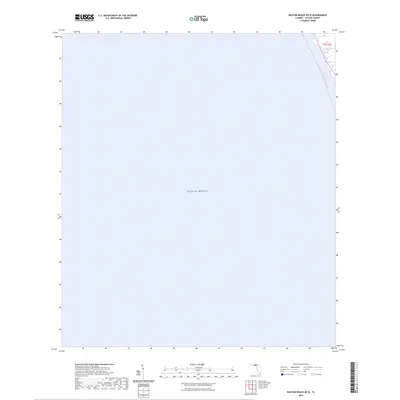
2024 Map of Keaton Beach OE W
USGS Topo · Published 2024About this map
The Gulf of Mexico dominates this coastal survey of Taylor County, Florida, where the open water meets the low-lying marshlands of the Big Bend. A specialized marine route, the Florida Circumnavigational Paddling Trl, traverses the northeastern corner of the map, providing a glimpse into the modern recreational use of this saltwater wilderness. The absence of land-based infrastructure or settlements across the majority of the sheet emphasizes the expansive nature of the offshore environment, with only the very edge of the coastline appearing near the township marker for t7s r7e.
Find a feature on this map
3 named features on this map. Tap any name to fly to it.
Don’t see what you’re looking for? This feature index may not catch every label — zoom into the map to look around manually.
Map Details
Editions of this 2024 Keaton Beach OE W Map
This is the sole edition of this map. No revisions or reprints were ever made.
Other maps of this area

1954 · Warrior Swamp
USGS Topo · 1:24,000

1954 · Keaton Beach
USGS Topo · 1:24,000

1954 · Okefenokee Slough
USGS Topo · 1:24,000

1954 · Crooked Point
USGS Topo · 1:24,000

1954 · Gainesville
USGS Topo · 1:250,000

1955 · Rock Islands
USGS Topo · 1:24,000

1958 · Gainesville
USGS Topo · 1:250,000

1959 · Gainesville
USGS Topo · 1:250,000
1978 · Cross City
USGS Topo · 1:100,000
1994 · Rock Islands
USGS Topo · 1:24,000