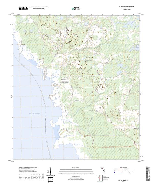
2025 Map of Keaton Beach
USGS Topo · Published 2025About this map
Keaton Beach and Dekle Beach anchor this coastal stretch of Taylor County, where the Gulf of Mexico meets a complex network of marshes and tidal creeks. The settlement pattern is defined by these small waterfront communities, connected by roads such as Dekle Beach Rd and Co Rd 361C. Further inland, the landscape transitions into a series of distinctive wetlands known locally as sogs, including Stanley Sog and Coker Sog.
Find a feature on this map
71 named features on this map. Tap any name to fly to it.
Don’t see what you’re looking for? This feature index may not catch every label — zoom into the map to look around manually.
Map Details
Editions of this 2025 Keaton Beach Map
This is the sole edition of this map. No revisions or reprints were ever made.
Other maps of this area

1954 · Salem SW
USGS Topo · 1:24,000

1954 · Warrior Swamp
USGS Topo · 1:24,000

1954 · Salem
USGS Topo · 1:24,000

1954 · Steinhatchee
USGS Topo · 1:24,000

1954 · Keaton Beach
USGS Topo · 1:24,000

1954 · Okefenokee Slough
USGS Topo · 1:24,000

1954 · Crooked Point
USGS Topo · 1:24,000

1954 · Gainesville
USGS Topo · 1:250,000

1958 · Gainesville
USGS Topo · 1:250,000

1959 · Gainesville
USGS Topo · 1:250,000