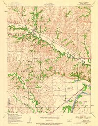
1955 Map of Keats
USGS Topo · Published 1958About this map
Keats sits at the intersection of local topography and industrial transit, serving as a key point on the Chicago Rock Island and Pacific railroad line. The landscape is defined by the winding course of Wildcat Creek, which cuts through the western edge of the Manhattan hills before the terrain levels out into the Ashland Bottoms near the Kansas River. This mid-century survey reveals a transition from the structured military landscape of the Fort Riley Military Reservation and Ogden in the south to the agricultural and institutional developments of the eastern flats.
Find a feature on this map
28 named features on this map. Tap any name to fly to it.
Don’t see what you’re looking for? This feature index may not catch every label — zoom into the map to look around manually.
Map Details
Editions of this 1955 Keats Map
2 editions found
Other maps of this area

1886 · Junction City
USGS Topo · 1:125,000

1889 · Junction City
USGS Topo · 1:125,000

1894 · Junction City
USGS Topo · 1:125,000

1947 · Manhattan
USGS Topo · 1:62,500

1947 · Fort Riley
USGS Topo · 1:62,500

1950 · Keats
USGS Topo · 1:24,000

1950 · Manhattan
USGS Topo · 1:24,000

1950 · Junction City
USGS Topo · 1:24,000

1951 · Swede Creek
USGS Topo · 1:24,000

1951 · Ogden
USGS Topo · 1:24,000