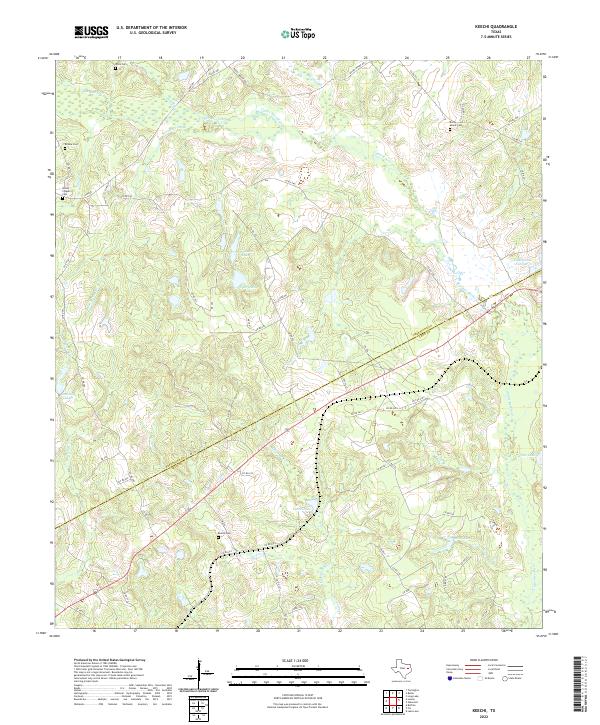
2022 Map of Keechi
USGS Topo · Published 2022About this map
The boundary between Freestone and Leon County bisects this rural landscape, which is defined by the winding course of Upper Keechi Creek and its many tributaries. This area is characterized by family-named landmarks and water bodies, including S C Pickens Lake and T B Pickens Lake, which suggest a long-standing pattern of private land ownership and local agriculture. The terrain is marked by numerous sloughs and branches, such as Jelly Slough and Tan Yard Br, draining into larger basins like Keechi Lake. For those researching local family histories, the map identifies several rural burial grounds scattered across the county lines, including Rocky Mount Cem, Brooke Cem, and Keechi Cem. These sites, often located near historical homesteads or old routes like FM 489, provide essential geographic markers for genealogists tracing families in this part of East Texas.
Find a feature on this map
67 named features on this map. Tap any name to fly to it.
Don’t see what you’re looking for? This feature index may not catch every label — zoom into the map to look around manually.
Map Details
Editions of this 2022 Keechi Map
This is the sole edition of this map. No revisions or reprints were ever made.
Other maps of this area

1919 · Fairfield
USGS Topo · 1:62,500

1953 · Palestine
USGS Topo · 1:250,000

1954 · Waco
USGS Topo · 1:250,000

1955 · Waco
USGS Topo · 1:250,000

1956 · Jewett
USGS Topo · 1:62,500

1957 · Palestine
USGS Topo · 1:250,000

1964 · Long Lake
USGS Topo · 1:24,000

1964 · Oakwood
USGS Topo · 1:24,000

1964 · Flo
USGS Topo · 1:24,000

1964 · Keechi
USGS Topo · 1:24,000