
1951 Map of Keeler
USGS Topo · Published 1952About this map
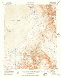
The shoreline of Owens Lake and the industrial activity of the Eastern Sierra dominate this early 1950s survey. The town of Keeler sits as a vital rail terminus for the Southern Pacific, supporting a local economy built on mineral extraction. Large Soda Evaporators and the Soda Products Plant edge the lakebed, while a Tramway reaches into the heights of the Inyo Mountains. The landscape reflects a transition from high-desert peaks to the valley floor, where the L A Aqueduct and numerous Pipe Lines trace the movement of water across Owens Valley. To the south, specialized features like the Sierra Talc Mine and the curiosly named Dirty Socks (Hot Spring) indicate a rugged environment of diverse geological and geothermal interest, from the Sand Dunes to the isolated Adamson Landing Field.
Find a feature on this map
30 named features on this map. Tap any name to fly to it.
Don’t see what you’re looking for? This feature index may not catch every label — zoom into the map to look around manually.
Map Details
Editions of this 1951 Keeler Map
4 editions found
Other maps of this area

1905 · Olancha
USGS Topo · 1:125,000

1907 · Olancha
USGS Topo · 1:125,000

1907 · Mt. Whitney
USGS Topo · 1:125,000

1908 · Ballarat
USGS Topo · 1:250,000

1913 · Ballarat
USGS Topo · 1:250,000

1919 · Mt. Whitney
USGS Topo · 1:125,000

1937 · Mt. Whitney
USGS Topo · 1:125,000

1948 · Death Valley
USGS Topo · 1:250,000

1948 · Fresno
USGS Topo · 1:250,000

1950 · Darwin
USGS Topo · 1:62,500