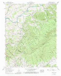
1960 Map of Keenburg
USGS Topo · Published 1988About this map
Holston Mountain dominates the landscape of this 1960 Tennessee survey, where the rugged topography of the Cherokee National Forest meets the developed valleys of Sullivan and Carter counties. The South Fork Holston River snakes through the northern reaches, feeding into Boone Lake, while the Watauga River defines the southern boundary near Biltmore. This area is particularly detailed in its mapping of family and community landmarks, including numerous small burial grounds like McKinney Cem and Vanh Over Cem.
Find a feature on this map
110 named features on this map. Tap any name to fly to it.
Don’t see what you’re looking for? This feature index may not catch every label — zoom into the map to look around manually.
Map Details
Editions of this 1960 Keenburg Map
3 editions found
Other maps of this area

1891 · Roan Mountain
USGS Topo · 1:125,000

1894 · Roan Mountain
USGS Topo · 1:125,000

1897 · Bristol
USGS Topo · 1:125,000

1902 · Bristol
USGS Topo · 1:125,000

1904 · Roan Mountain
USGS Topo · 1:125,000

1934 · Holston Valley
USGS Topo · 1:24,000

1934 · Bristol
USGS Topo · 1:24,000

1935 · Watauga Valley
USGS Topo · 1:48,000

1935 · Blountville
USGS Topo · 1:24,000
1935 · Carter
USGS Topo · 1:24,000