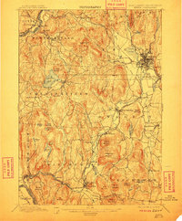
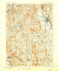
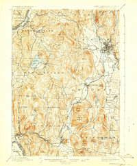
1898 Map of Keene
USGS Topo · Published 1911About this map
The Ashuelot River carves a central path through this late 19th-century survey of Cheshire County, anchoring a landscape where industrial transit and rugged topography converge. At the turn of the century, Keene serves as a vital rail hub, where the Fitchburg Division and the Cheshire Branch of the Boston and Maine R.R. meet. The map reveals a dense network of water-dependent features, from the industrial Ashuelot and Hinsdale clusters to the recreational waters of Spofford Lake.
Find a feature on this map
78 named features on this map. Tap any name to fly to it.
Don’t see what you’re looking for? This feature index may not catch every label — zoom into the map to look around manually.
Map Details
Editions of this 1898 Keene Map
7 editions found

Other maps of this area

1887 · Warwick
USGS Topo · 1:62,500

1887 · Winchendon
USGS Topo · 1:62,500

1889 · Warwick
USGS Topo · 1:62,500

1890 · Greenfield
USGS Topo · 1:62,500

1890 · Winchendon
USGS Topo · 1:62,500

1891 · Brattleboro
USGS Topo · 1:62,500

1893 · Brattleboro
USGS Topo · 1:62,500

1894 · Winchendon
USGS Topo · 1:62,500

1894 · Greenfield
USGS Topo · 1:62,500

1894 · Warwick
USGS Topo · 1:62,500