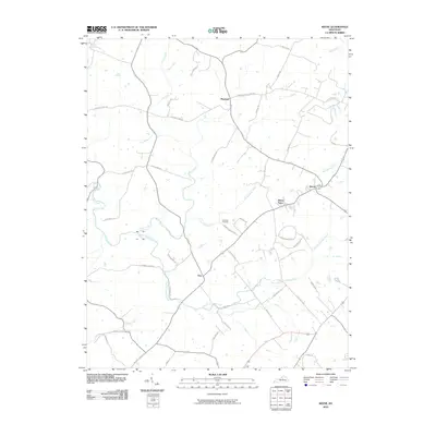
2010 Map of Keene
USGS Topo · Published 2010About this map
Keene and Troy anchor this landscape south of Lexington, where the Bluegrass region's agricultural roots are visible in a dense network of country roads and family-named lanes. The terrain is defined by the winding course of Clear Creek and its many tributaries, including East Fork Clear Creek and Cave Spring Creek. This 2010 survey shows the area's rural character preserved through landmarks like the Ebenezer Cemetery and the small settlement of Dixon Town. The road network provides evidence of historical land use and early transport routes, with named thoroughfares such as Fords Mill Rd, Kidds Mill Rd, and Delaney Ferry Rd tracing the paths that once connected local mills and river crossings. Northward, near Pinckard, the land transitions into the headwaters of Shannon Run, maintaining a patchwork of open space and residential clusters along corridors like Mundys Landing Rd.
Find a feature on this map
42 named features on this map. Tap any name to fly to it.
Don’t see what you’re looking for? This feature index may not catch every label — zoom into the map to look around manually.
Map Details
Editions of this 2010 Keene Map
This is the sole edition of this map. No revisions or reprints were ever made.
Other maps of this area

1905 · Harrodsburg
USGS Topo · 1:125,000

1906 · Georgetown
USGS Topo · 1:62,500

1908 · Georgetown
USGS Topo · 1:62,500

1922 · Frankfort
USGS Topo · 1:48,000

1924 · Frankfort
USGS Topo · 1:62,500

1950 · Lexington West
USGS Topo · 1:24,000

1952 · Keene
USGS Topo · 1:24,000

1952 · Little Hickman
USGS Topo · 1:24,000

1952 · Nicholasville
USGS Topo · 1:24,000

1952 · Harrodsburg
USGS Topo · 1:24,000