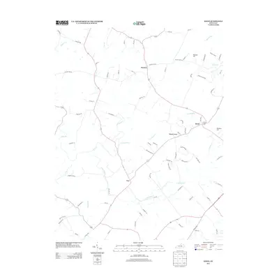
2013 Map of Keene
USGS Topo · Published 2013About this map
The settlement of Keene anchors this portion of Jessamine and Fayette counties, situated at a junction of early pikes and lanes. The landscape is defined by the complex hydrology of the Bluegrass region, where Clear Cr and its tributary E Fork Clear Cr drain a terrain marked by named elevations such as Meridian Hill. Small communities like Pinckard, Dixon Town, and Troy are interconnected by a dense network of historical routes, including Carpenter Pike and Delaneys Ferry Rd, reflecting the area's agricultural and transit legacy. Further east, the terrain transitions toward Pleasant Hill and the drainage of Sinking Cr, while Cave Spring Cr carves through the central hills. This survey documents the intersection of rural residential expansion and traditional Kentucky thoroughfares in the early twenty-first century.
Find a feature on this map
76 named features on this map. Tap any name to fly to it.
Don’t see what you’re looking for? This feature index may not catch every label — zoom into the map to look around manually.
Map Details
Editions of this 2013 Keene Map
This is the sole edition of this map. No revisions or reprints were ever made.
Other maps of this area

1905 · Harrodsburg
USGS Topo · 1:125,000

1906 · Georgetown
USGS Topo · 1:62,500

1908 · Georgetown
USGS Topo · 1:62,500

1922 · Frankfort
USGS Topo · 1:48,000

1924 · Frankfort
USGS Topo · 1:62,500

1950 · Lexington West
USGS Topo · 1:24,000

1952 · Keene
USGS Topo · 1:24,000

1952 · Little Hickman
USGS Topo · 1:24,000

1952 · Nicholasville
USGS Topo · 1:24,000

1952 · Harrodsburg
USGS Topo · 1:24,000