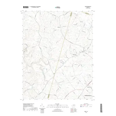
2019 Map of Keene
USGS Topo · Published 2019About this map
Keene and Dixon Town anchor this survey of the Bluegrass region south of the Fayette County and Jessamine County line. The landscape is defined by a dense network of historic pikes and rural cemeteries that trace the settlement patterns of early Kentucky families. Genealogists will find numerous small burial grounds, including the Frost, Salliee, and Ebenezer cemeteries, often located near winding watercourses like Cave Spring Creek and Clear Creek. The settlement at Troy sits at the junction of several historic routes, including Troy Pike and Fords Mill Road, reflecting the area's agricultural and milling heritage. To the south, the expansion of Wilmore and Nicholasville begins to touch the edges of this rolling farm country, while the northern sections near Pinckard remain centered on large estates and thoroughbred culture along Delaney Ferry Road.
Find a feature on this map
91 named features on this map. Tap any name to fly to it.
Don’t see what you’re looking for? This feature index may not catch every label — zoom into the map to look around manually.
Map Details
Editions of this 2019 Keene Map
This is the sole edition of this map. No revisions or reprints were ever made.
Other maps of this area

1905 · Harrodsburg
USGS Topo · 1:125,000

1906 · Georgetown
USGS Topo · 1:62,500

1908 · Georgetown
USGS Topo · 1:62,500

1922 · Frankfort
USGS Topo · 1:48,000

1924 · Frankfort
USGS Topo · 1:62,500

1950 · Lexington West
USGS Topo · 1:24,000

1952 · Keene
USGS Topo · 1:24,000

1952 · Little Hickman
USGS Topo · 1:24,000

1952 · Nicholasville
USGS Topo · 1:24,000

1952 · Harrodsburg
USGS Topo · 1:24,000