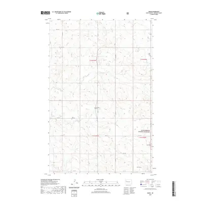
2020 Map of Keene
USGS Topo · Published 2020About this map
Keene serves as the central hub of this western North Dakota landscape, situated within a section of the Little Missouri National Grassland. The terrain is defined by the prominent Blue Buttes to the south and Stony Butte to the east, illustrating the broken topography characteristic of the Missouri Plateau. For genealogists and local historians, the map preserves the locations of the West Prairie Cem and Clear Creek Cem, which mark the early 20th-century settlement patterns of McKenzie County. A network of rural section-line roads, including Co Rte 55 and Co Rte 12, connects these remote sites. The drainage systems of Clear Cr, its North Branch, and Sand Cr carve through the high prairie, dictating the placement of ranching infrastructure and local thoroughfares.
Find a feature on this map
28 named features on this map. Tap any name to fly to it.
Don’t see what you’re looking for? This feature index may not catch every label — zoom into the map to look around manually.
Map Details
Editions of this 2020 Keene Map
This is the sole edition of this map. No revisions or reprints were ever made.
Other maps of this area

1911 · Ray
USGS Topo · 1:125,000

1953 · Williston
USGS Topo · 1:250,000

1953 · Watford City
USGS Topo · 1:250,000

1957 · Williston
USGS Topo · 1:250,000

1957 · Watford City
USGS Topo · 1:250,000

1965 · Keene
USGS Topo · 1:24,000

1965 · Johnsons Corner
USGS Topo · 1:24,000

1965 · Charlson
USGS Topo · 1:24,000

1965 · Blue Buttes
USGS Topo · 1:24,000

1965 · Charlson SW
USGS Topo · 1:24,000