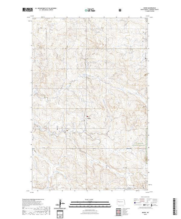
2024 Map of Keene
USGS Topo · Published 2024About this map
Keene sits at the heart of this McKenzie County landscape, where the high plains meet the intricate drainage systems of the Missouri River basin. The area is defined by a network of seasonal watercourses, most notably the North Branch Clear Creek and the main stem of Clear Creek, which carve through the terrain. To the southeast, the prominent elevations of the Blue Buttes rise above the surrounding prairie. This region also encompasses a portion of the Little Missouri National Grassland, highlighting the local balance between agricultural use and protected rangeland. Local history is anchored by sites such as West Prairie Cem on the eastern edge and Clear Creek Cem near the central crossroads, serving as lasting markers of the rural community’s genealogy and settlement patterns.
Find a feature on this map
27 named features on this map. Tap any name to fly to it.
Don’t see what you’re looking for? This feature index may not catch every label — zoom into the map to look around manually.
Map Details
Editions of this 2024 Keene Map
This is the sole edition of this map. No revisions or reprints were ever made.
Other maps of this area

1911 · Ray
USGS Topo · 1:125,000

1953 · Williston
USGS Topo · 1:250,000

1953 · Watford City
USGS Topo · 1:250,000

1957 · Williston
USGS Topo · 1:250,000

1957 · Watford City
USGS Topo · 1:250,000

1965 · Keene
USGS Topo · 1:24,000

1965 · Johnsons Corner
USGS Topo · 1:24,000

1965 · Charlson
USGS Topo · 1:24,000

1965 · Blue Buttes
USGS Topo · 1:24,000

1965 · Charlson SW
USGS Topo · 1:24,000