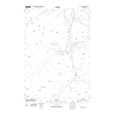
2010 Map of Keene Valley
USGS Topo · Published 2010About this map
The East Branch Ausable River carves a deep path through this Adirondack landscape, anchoring the settlements of Keene Valley and Saint Huberts during the early 21st century. The valley floor is marked by a sequence of historical burial sites, including Norton Cemetery, Shaw Cemetery, and Holt Cemetery, which offer valuable data for genealogical research in Essex County. Surrounding the narrow inhabited corridor is a formidable collection of peaks, from Cascade Mountain and Porter Mountain in the west to the southern high ground of Upper Wolfjaw Mountain and Armstrong Mountain.
Find a feature on this map
96 named features on this map. Tap any name to fly to it.
Don’t see what you’re looking for? This feature index may not catch every label — zoom into the map to look around manually.
Map Details
Editions of this 2010 Keene Valley Map
This is the sole edition of this map. No revisions or reprints were ever made.
Other maps of this area

1894 · Elizabethtown
USGS Topo · 1:62,500

1895 · Elizabethtown
USGS Topo · 1:62,500

1895 · Mt. Marcy
USGS Topo · 1:62,500

1895 · Ausable
USGS Topo · 1:62,500

1896 · Lake Placid
USGS Topo · 1:62,500

1898 · Lake Placid
USGS Topo · 1:62,500

1901 · Elizabethtown
USGS Topo · 1:62,500

1902 · Mt. Marcy
USGS Topo · 1:62,500

1903 · Ausable
USGS Topo · 1:62,500

1950 · Lake Champlain
USGS Topo · 1:250,000