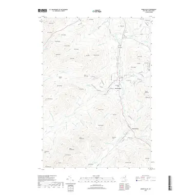
2019 Map of Keene Valley
USGS Topo · Published 2019About this map
Keene Valley sits at the heart of this Adirondack landscape, where the East Branch Ausable River winds through a valley flanked by the high peaks of the Cascade Range. This area, documented in the early 21st century, shows a concentrated settlement pattern around the river and Marcy Field, while the surrounding terrain is defined by dramatic elevations such as Cascade Mtn and Porter Mtn. The map records numerous family-named burial grounds, including Norton Cem, Shaw Cem, and Holt Cem, which serve as significant markers for local genealogical research.
Find a feature on this map
125 named features on this map. Tap any name to fly to it.
Don’t see what you’re looking for? This feature index may not catch every label — zoom into the map to look around manually.
Map Details
Editions of this 2019 Keene Valley Map
This is the sole edition of this map. No revisions or reprints were ever made.
Other maps of this area

1894 · Elizabethtown
USGS Topo · 1:62,500

1895 · Elizabethtown
USGS Topo · 1:62,500

1895 · Mt. Marcy
USGS Topo · 1:62,500

1895 · Ausable
USGS Topo · 1:62,500

1896 · Lake Placid
USGS Topo · 1:62,500

1898 · Lake Placid
USGS Topo · 1:62,500

1901 · Elizabethtown
USGS Topo · 1:62,500

1902 · Mt. Marcy
USGS Topo · 1:62,500

1903 · Ausable
USGS Topo · 1:62,500

1950 · Lake Champlain
USGS Topo · 1:250,000