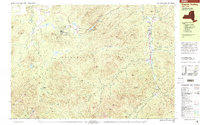
1999 Map of Keene Valley
USGS Topo · Published 2001About this map
The Mt Van Hoevenberg State Recreation Area stands as a central feature in this late-twentieth-century study of the High Peaks region, detailing the specialized infrastructure of the Bobsled Run, Luge Run, and Cross Country Stadium. This area, situated within the vast Adirondack Park, illustrates the intersection of international winter sports heritage and preserved wilderness. To the northwest, the John Brown Farm State Historic Site marks a significant cultural landmark near North Elba.
Find a feature on this map
97 named features on this map. Tap any name to fly to it.
Don’t see what you’re looking for? This feature index may not catch every label — zoom into the map to look around manually.
Map Details
Editions of this 1999 Keene Valley Map
This is the sole edition of this map. No revisions or reprints were ever made.
Other maps of this area

1894 · Elizabethtown
USGS Topo · 1:62,500

1895 · Elizabethtown
USGS Topo · 1:62,500

1895 · Mt. Marcy
USGS Topo · 1:62,500

1895 · Ausable
USGS Topo · 1:62,500

1896 · Lake Placid
USGS Topo · 1:62,500

1898 · Lake Placid
USGS Topo · 1:62,500

1901 · Elizabethtown
USGS Topo · 1:62,500

1902 · Mt. Marcy
USGS Topo · 1:62,500

1902 · Saranac
USGS Topo · 1:62,500

1903 · Ausable
USGS Topo · 1:62,500