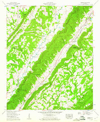
1959 Map of Keener
USGS Topo · Published 1960About this map
Big Wills Valley and Little Wills Valley dominate this landscape, nestled between the prominent ridges of Sand Mountain and Lookout Mountain. The settlement pattern follows the fertile valleys and the Southern Railway corridor, which connects rural communities like Keener and Flanders. A series of gaps through the ridges, including Ward Gap, Campbell Gap, and Keener Gap, highlight the historical importance of mountain passes for local travel and commerce between the De Kalb Co Etowah Co line. Mapping by the Tennessee Valley Authority reveals a network of country churches and family cemeteries, such as Duck Springs Cems and Mathis Cem, that served the scattered farmsteads of the late 1950s. Water features like Big Wills Creek and several springs provided the essential resources for the agricultural life that defined this corner of northeast Alabama.
Find a feature on this map
67 named features on this map. Tap any name to fly to it.
Don’t see what you’re looking for? This feature index may not catch every label — zoom into the map to look around manually.
Map Details
Editions of this 1959 Keener Map
3 editions found
Other maps of this area

1885 · Gadsden
USGS Topo · 1:125,000

1888 · Gadsden
USGS Topo · 1:125,000

1892 · Gadsden
USGS Topo · 1:125,000

1893 · Fort Payne
USGS Topo · 1:125,000

1895 · Gadsden
USGS Topo · 1:125,000

1898 · Fort Payne
USGS Topo · 1:125,000

1900 · Fort Payne
USGS Topo · 1:125,000

1903 · Gadsden
USGS Topo · 1:125,000

1936 · Painter
USGS Topo · 1:24,000

1936 · Crossville
USGS Topo · 1:24,000