
1956 Map of Keentown
USGS Topo · Published 1957About this map
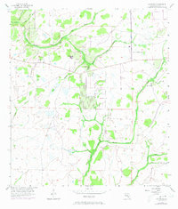
Keentown sits at the nexus of the Manatee River system during the mid-1950s, a landscape defined by the intricate hydrology of the North Fork Manatee River and its various tributaries. The settlement is anchored by local landmarks such as Keen Cem and the Bunker Hill Ch, which provide essential touchstones for genealogical research in this part of Manatee County. The terrain is characterized by a mix of wetlands and higher ground, notably Peacock Hammock, while the drainage patterns of Graveyard Creek and Keen Branch illustrate the area's natural state before significant modern development. This era of the map captures the region when small rural communities were still closely tied to the surrounding river forks and wooded branches, including the South Fork Little Manatee River and Moody Branch.
Find a feature on this map
26 named features on this map. Tap any name to fly to it.
Don’t see what you’re looking for? This feature index may not catch every label — zoom into the map to look around manually.
Map Details
Editions of this 1956 Keentown Map
3 editions found
Other maps of this area

1944 · Rye
USGS Topo · 1:31,680

1944 · Wimauma
USGS Topo · 1:31,680

1944 · Verna
USGS Topo · 1:31,680

1947 · Wimauma
USGS Topo · 1:25,000

1956 · Myakka City NW
USGS Topo · 1:24,000

1956 · Ft Lonesome
USGS Topo · 1:24,000

1956 · Myakka Head
USGS Topo · 1:24,000

1956 · Duette NE
USGS Topo · 1:24,000
1956 · Wimauma
USGS Topo · 1:24,000

1956 · Duette
USGS Topo · 1:24,000