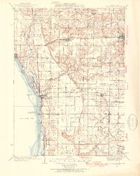
1935 Map of Keithsburg
USGS Topo · Published 1954About this map
Keithsburg and the riverfront towns of western Mercer County dominate this mid-1930s landscape along the Mississippi River. The map reveals a highly developed agricultural interior supported by a dense network of one-room schoolhouses such as Hazel Dell Sch and Belmont Sch, and small religious centers like Daniel Ch. The regional economy is defined by the intersection of water and rail, with the Minneapolis and St Louis RR and the Chicago Burlington and Quincy RR cutting across the prairies to reach river ports.
Find a feature on this map
67 named features on this map. Tap any name to fly to it.
Don’t see what you’re looking for? This feature index may not catch every label — zoom into the map to look around manually.
Map Details
Editions of this 1935 Keithsburg Map
4 editions found
Other maps of this area

1912 · Milan
USGS Topo · 1:62,500

1916 · Edgington
USGS Topo · 1:62,500

1921 · Monmouth
USGS Topo · 1:62,500

1923 · Monmouth
USGS Topo · 1:62,500

1923 · Alexis
USGS Topo · 1:62,500

1925 · Alexis
USGS Topo · 1:62,500

1934 · Oquawka
USGS Topo · 1:48,000

1934 · Burlington
USGS Topo · 1:48,000

1935 · Keithsburg
USGS Topo · 1:48,000

1938 · Edgington
USGS Topo · 1:62,500