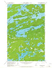
1959 Map of Kekekabic Lake
USGS Topo · Published 1965About this map
Kekekabic Lake anchors this 1959 survey of the Boundary Waters region, where the Canada-United States international border cuts through the center of Knife Lake. This remote portion of Lake County is defined by a dense network of interconnected waterways and portages that span the Quetico Provincial Park to the north and the Superior National Forest to the south. The topography is characterized by a series of long, finger-like lakes such as Fraser Lake and Thomas Lake, separated by narrow ridges and forest land managed under the Minnesota State Forest system.
Find a feature on this map
60 named features on this map. Tap any name to fly to it.
Don’t see what you’re looking for? This feature index may not catch every label — zoom into the map to look around manually.
Map Details
Editions of this 1959 Kekekabic Lake Map
3 editions found
Other maps of this area

1954 · Two Harbors
USGS Topo · 1:250,000

1957 · Two Harbors
USGS Topo · 1:250,000

1957 · Ensign Lake
USGS Topo · 1:62,500

1957 · Quetico
USGS Topo · 1:250,000

1958 · Two Harbors
USGS Topo · 1:250,000

1959 · Ogishkemuncie Lake
USGS Topo · 1:24,000

1959 · Kekekabic Lake
USGS Topo · 1:24,000

1959 · Dutton Lake
USGS Topo · 1:24,000

1959 · Ester Lake
USGS Topo · 1:24,000

1960 · Lake Polly
USGS Topo · 1:24,000