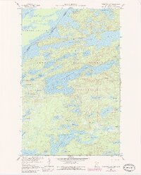
1959 Map of Kekekabic Lake
USGS Topo · Published 1986About this map
The International Boundary bisects the north-central portion of this survey, dividing the Quetico Provincial Park of Ontario from the Superior National Forest in Minnesota. This mid-century record documents the transition of this area into the Boundary Waters Canoe Area Wilderness, preserving a landscape of interconnected glacial lakes and dense woodland. Prominent water bodies such as Kekekabic Lake, Knife Lake, and Fraser Lake dominate the terrain, reflecting the region's importance to early canoe routes and conservation efforts. The Kekekabic Lookout Tower stands as a rare vertical landmark in a territory otherwise defined by low-relief portages and rocky shorelines. The map also captures the topography of Hunter Island and numerous smaller basins like Spoon Lake and Thomas Lake, detailing the intricate hydrologic network before modern wilderness management protocols were fully established.
Find a feature on this map
63 named features on this map. Tap any name to fly to it.
Don’t see what you’re looking for? This feature index may not catch every label — zoom into the map to look around manually.
Map Details
Editions of this 1959 Kekekabic Lake Map
3 editions found
Other maps of this area

1954 · Two Harbors
USGS Topo · 1:250,000

1957 · Two Harbors
USGS Topo · 1:250,000

1957 · Ensign Lake
USGS Topo · 1:62,500

1957 · Quetico
USGS Topo · 1:250,000

1958 · Two Harbors
USGS Topo · 1:250,000

1959 · Ogishkemuncie Lake
USGS Topo · 1:24,000

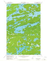
1959 · Kekekabic Lake
USGS Topo · 1:24,000

1959 · Dutton Lake
USGS Topo · 1:24,000

1959 · Ester Lake
USGS Topo · 1:24,000

1960 · Lake Polly
USGS Topo · 1:24,000