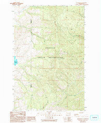
1989 Map of Keller Butte
USGS Topo · Published 1994About this map
The Colville Indian Reservation landscape is defined by the high prominence of Keller Butte, crowned with a Lookout Tower that surveys the surrounding drainage basins. This late-twentieth-century survey documents a terrain deeply etched by seasonal and permanent waterways, including Joe Moses Creek in the north and the converging flows of Manila Creek and Peter Dan Creek in the south. The presence of a Prospect label northwest of the butte hints at the area's mineral exploration history, while the clear boundary between Okanogan and Ferry counties runs vertically through the rugged western ridges. To the west, the shoreline of Buffalo Lake provides a distinct break from the densely contoured uplands, serving as a significant landmark in this sparsely settled region of northeastern Washington.
Find a feature on this map
12 named features on this map. Tap any name to fly to it.
Don’t see what you’re looking for? This feature index may not catch every label — zoom into the map to look around manually.
Map Details
Editions of this 1989 Keller Butte Map
2 editions found
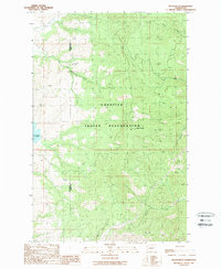
Other maps of this area

1948 · Grand Coulee Dam
USGS Topo · 1:62,500

1948 · Wilbur
USGS Topo · 1:62,500

1950 · Wilbur
USGS Topo · 1:62,500

1950 · Grand Coulee Dam
USGS Topo · 1:62,500

1950 · Nespelem
USGS Topo · 1:62,500

1952 · Keller
USGS Topo · 1:62,500

1953 · Ritzville
USGS Topo · 1:250,000

1954 · Okanogan
USGS Topo · 1:250,000

1958 · Okanogan
USGS Topo · 1:250,000

1959 · Ritzville
USGS Topo · 1:250,000