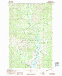
1989 Map of Keller
USGS Topo · Published 1989About this map
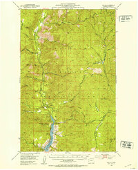
The Colville Indian Reservation landscape is defined by the deep valley of the Sanpoil River as it flows south toward the Columbia River. In the late 1980s, the settlement of Keller serves as a local hub near the river's confluence with the backed-up waters of Franklin D Roosevelt Lake. The terrain is marked by extractive history and land management, with numerous prospects, a mine, and gravel pits scattered throughout the draws of Jack Creek and Meadow Creek. To the south, the Coulee Dam National Recreation Area buffers the lake shoreline, supporting local access with a campground and boat ramp. Rising above the river valley, Mount Tolman stands as a prominent geographic landmark, while smaller settlements like Empire and a trailer park dot the northern reaches of the river corridor.
Find a feature on this map
28 named features on this map. Tap any name to fly to it.
Don’t see what you’re looking for? This feature index may not catch every label — zoom into the map to look around manually.
Map Details
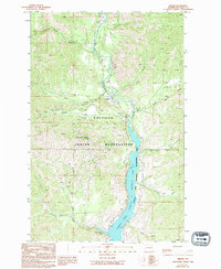
Editions of this 1989 Keller Map
2 editions found
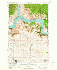
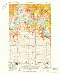
Other maps of this area

1948 · Grand Coulee Dam
USGS Topo · 1:62,500
1948 · Wilbur
USGS Topo · 1:62,500
1950 · Wilbur
USGS Topo · 1:62,500

1950 · Grand Coulee Dam
USGS Topo · 1:62,500

1950 · Nespelem
USGS Topo · 1:62,500
1952 · Keller
USGS Topo · 1:62,500

1953 · Ritzville
USGS Topo · 1:250,000

1954 · Okanogan
USGS Topo · 1:250,000

1958 · Okanogan
USGS Topo · 1:250,000

1959 · Ritzville
USGS Topo · 1:250,000