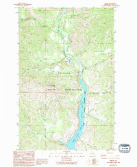
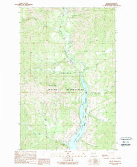
1989 Map of Keller
USGS Topo · Published 1994About this map
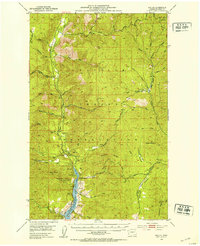
The Sanpoil River valley defines the character of this Ferry County landscape, where the river widens significantly into Franklin D Roosevelt Lake (Sanpoil River). Centered on the settlement of Keller, the terrain is dominated by the mountainous boundaries of the Colville Indian Reservation. High ridges like Watson Ridge and peaks including Mount Tolman overlook a complex network of drainages such as Manila Creek and Meadow Creek. The map documents a rugged interior economy marked by numerous mining indicators, including Mine and Prospect labels throughout the hills, particularly around the Sanpoil corridor. Historical land use is further evidenced by a Cem near Keller and the inclusion of French Johns Lake in the southern reaches. This late-century survey illustrates the balance between natural resource extraction and the establishment of the National Recreation Area along the expanded riverfront.
Find a feature on this map
23 named features on this map. Tap any name to fly to it.
Don’t see what you’re looking for? This feature index may not catch every label — zoom into the map to look around manually.
Map Details
Editions of this 1989 Keller Map
2 editions found
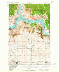
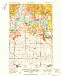
Other maps of this area

1948 · Grand Coulee Dam
USGS Topo · 1:62,500
1948 · Wilbur
USGS Topo · 1:62,500
1950 · Wilbur
USGS Topo · 1:62,500

1950 · Grand Coulee Dam
USGS Topo · 1:62,500

1950 · Nespelem
USGS Topo · 1:62,500
1952 · Keller
USGS Topo · 1:62,500

1953 · Ritzville
USGS Topo · 1:250,000

1954 · Okanogan
USGS Topo · 1:250,000

1958 · Okanogan
USGS Topo · 1:250,000

1959 · Ritzville
USGS Topo · 1:250,000