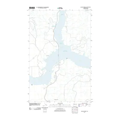
2011 Map of Keller Ferry
USGS Topo · Published 2011About this map
Franklin D Roosevelt Lake dominates the center of this Lincoln County landscape, where the waters of the Columbia River back up into the Sanpoil River Arm. The central transport link is the historic Keller Ferry, which connects State Route 21 across the wide expanse of the reservoir. The topography is defined by dramatic rises such as China Bluff and Camel Bluff, alongside the winding route of Speigle Canyon to the south. Local access is marked by residential corridors like Lupine Dr N and Sanpoil Ln, while smaller water bodies like French Johns Lake sit perched above the main channel. This survey documents the intersection of modern road infrastructure with the high-water marks and shoreline features like Clark Point and Moonbeam Bay.
Find a feature on this map
16 named features on this map. Tap any name to fly to it.
Don’t see what you’re looking for? This feature index may not catch every label — zoom into the map to look around manually.
Map Details
Editions of this 2011 Keller Ferry Map
This is the sole edition of this map. No revisions or reprints were ever made.
Other maps of this area

1948 · Grand Coulee Dam
USGS Topo · 1:62,500

1948 · Wilbur
USGS Topo · 1:62,500

1950 · Wilbur
USGS Topo · 1:62,500

1950 · Grand Coulee Dam
USGS Topo · 1:62,500

1950 · Nespelem
USGS Topo · 1:62,500

1952 · Keller
USGS Topo · 1:62,500

1953 · Ritzville
USGS Topo · 1:250,000

1954 · Okanogan
USGS Topo · 1:250,000

1958 · Okanogan
USGS Topo · 1:250,000

1959 · Ritzville
USGS Topo · 1:250,000