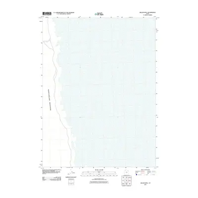
2011 Map of Keller Well
USGS Topo · Published 2011About this map
Newfoundland Mountains dominate the western margin of this desert landscape, where the stark topography of the range meets the level expanse of the surrounding flats. This 2011 survey by the U. S. Geological Survey details a remote portion of Tooele County defined by its scarcity of water and extreme isolation. The primary point of interest is Keller Well, a solitary water source situated at the base of the mountains that has long served as a vital landmark for those navigating this arid environment. The map illustrates the sharp contrast between the steep, rising terrain of the range and the vast, featureless basins, highlighting the unique geological and hydrological challenges found in this part of the Great Basin.
Find a feature on this map
2 named features on this map. Tap any name to fly to it.
Don’t see what you’re looking for? This feature index may not catch every label — zoom into the map to look around manually.
Map Details
Editions of this 2011 Keller Well Map
This is the sole edition of this map. No revisions or reprints were ever made.
Other maps of this area

1953 · Tooele
USGS Topo · 1:250,000

1954 · Brigham City
USGS Topo · 1:250,000

1955 · Tooele
USGS Topo · 1:250,000

1958 · Brigham City
USGS Topo · 1:250,000

1962 · Brigham City
USGS Topo · 1:250,000

1973 · Knolls 2 NW
USGS Topo · 1:24,000

1973 · Knolls 2 NE
USGS Topo · 1:24,000

1973 · Finger Ridge
USGS Topo · 1:24,000
1979 · Bonneville Salt Flats
USGS Topo · 1:100,000

1983 · Desert Peak
USGS Topo · 1:24,000