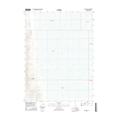
2017 Map of Keller Well
USGS Topo · Published 2017About this map
Newfoundland Mountains dominate the western edge of this Great Salt Lake Desert landscape, providing a stark topographical contrast to the surrounding salt flats. The eastern two-thirds of the quadrangle consist of the expansive, level terrain of the desert floor, gridded by the Public Land Survey System into townships and ranges such as t4n r13w. Near the northern slopes where the mountains meet the desert, Keller Well serves as a lonely landmark of human presence. This map documents a region defined by its extreme isolation and the clear division between the steep, desert mountain range and the low-lying alkali plains. The absence of modern roads or infrastructure outside of these sparse features emphasizes the enduring wilderness character of this part of northern Utah.
Find a feature on this map
8 named features on this map. Tap any name to fly to it.
Don’t see what you’re looking for? This feature index may not catch every label — zoom into the map to look around manually.
Map Details
Editions of this 2017 Keller Well Map
This is the sole edition of this map. No revisions or reprints were ever made.
Other maps of this area

1953 · Tooele
USGS Topo · 1:250,000

1954 · Brigham City
USGS Topo · 1:250,000

1955 · Tooele
USGS Topo · 1:250,000

1958 · Brigham City
USGS Topo · 1:250,000

1962 · Brigham City
USGS Topo · 1:250,000

1973 · Knolls 2 NW
USGS Topo · 1:24,000

1973 · Knolls 2 NE
USGS Topo · 1:24,000

1973 · Finger Ridge
USGS Topo · 1:24,000
1979 · Bonneville Salt Flats
USGS Topo · 1:100,000

1983 · Desert Peak
USGS Topo · 1:24,000