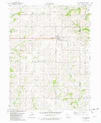
1981 Map of Kellerton
USGS Topo · Published 1982About this map
Kellerton serves as the central hub of this agricultural landscape in Ringgold County, sitting at a benchmark elevation of 1204 feet. The town's layout is clearly defined, situated just east of a Rest Area and the local Maple Row Cem. A significant historical element is the Old Railroad Grade that bisects the landscape, providing a clear path for those tracing former transportation corridors through Monroe and Athens townships.
Find a feature on this map
22 named features on this map. Tap any name to fly to it.
Don’t see what you’re looking for? This feature index may not catch every label — zoom into the map to look around manually.
Map Details
Editions of this 1981 Kellerton Map
This is the sole edition of this map. No revisions or reprints were ever made.
Other maps of this area

1945 · Mount Ayr
USGS Topo · 1:62,500

1945 · Lamoni
USGS Topo · 1:62,500

1947 · Lamoni
USGS Topo · 1:62,500

1947 · Mount Ayr
USGS Topo · 1:62,500

1954 · Centerville
USGS Topo · 1:250,000

1955 · Nebraska City
USGS Topo · 1:250,000

1957 · Nebraska City
USGS Topo · 1:250,000

1957 · Centerville
USGS Topo · 1:250,000

1958 · Centerville
USGS Topo · 1:250,000

1958 · Nebraska City
USGS Topo · 1:250,000