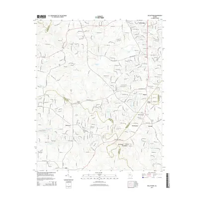
2014 Map of Kelleytown
USGS Topo · Published 2014About this map
The South River and Big Cotton Indian Creek wind through the borderlands of DeKalb, Rockdale, Henry, and Newton counties, defining a landscape of residential growth and long-held family sites. In the southern portion of the sheet, the community of Kelleytown is anchored by the Kelley Chapel and nearby Thompson Cem, while more remote burial grounds like the Hartfield and Everitt Cem reflect the area's rural genealogy. Several water bodies, including Monastery Lake, Crumbley Lake, and Dickson Lake, are prominent landmarks within the suburban transitions. Historic crossing points such as Sims Bridge, Oglesby Bridge, and Ragan Bridge illustrate the established transit network over the local waterways. The map also documents named developments and clusters like Rio Ranch, Barrington, and Stone Creek, showing the 2014 extent of expansion near Conyers.
Find a feature on this map
49 named features on this map. Tap any name to fly to it.
Don’t see what you’re looking for? This feature index may not catch every label — zoom into the map to look around manually.
Map Details
Editions of this 2014 Kelleytown Map
This is the sole edition of this map. No revisions or reprints were ever made.
Other maps of this area

1888 · Atlanta
USGS Topo · 1:125,000

1890 · Atlanta
USGS Topo · 1:125,000

1892 · Atlanta
USGS Topo · 1:125,000

1895 · Atlanta
USGS Topo · 1:125,000

1896 · Monroe
USGS Topo · 1:125,000

1953 · Atlanta
USGS Topo · 1:250,000

1953 · Athens
USGS Topo · 1:250,000

1956 · Conyers
USGS Topo · 1:24,000

1956 · Redan
USGS Topo · 1:24,000

1957 · Atlanta
USGS Topo · 1:250,000