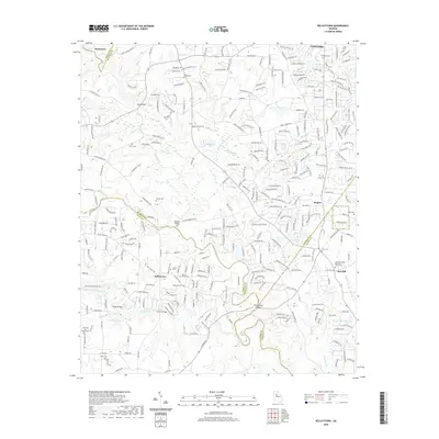
2020 Map of Kelleytown
USGS Topo · Published 2020About this map
Kelleytown and the surrounding river valleys of Rockdale and Henry Counties are documented here in detail, showcasing a landscape defined by the winding course of the South River and its numerous tributaries. The map highlights a significant concentration of family and community burial grounds, such as the Hartfield and Everitt Cem and Thompson Cem, which offer essential data for genealogical research in this part of Georgia.
Find a feature on this map
91 named features on this map. Tap any name to fly to it.
Don’t see what you’re looking for? This feature index may not catch every label — zoom into the map to look around manually.
Map Details
Editions of this 2020 Kelleytown Map
This is the sole edition of this map. No revisions or reprints were ever made.
Other maps of this area

1888 · Atlanta
USGS Topo · 1:125,000

1890 · Atlanta
USGS Topo · 1:125,000

1892 · Atlanta
USGS Topo · 1:125,000

1895 · Atlanta
USGS Topo · 1:125,000

1896 · Monroe
USGS Topo · 1:125,000

1953 · Atlanta
USGS Topo · 1:250,000

1953 · Athens
USGS Topo · 1:250,000
1956 · Conyers
USGS Topo · 1:24,000
1956 · Redan
USGS Topo · 1:24,000

1957 · Atlanta
USGS Topo · 1:250,000