2024 Map of Kelleytown
USGS Topo · Published 2024About this map
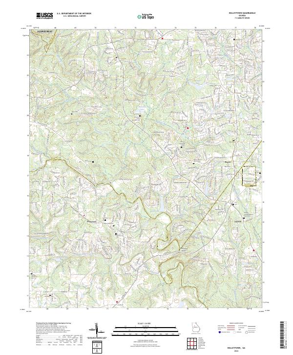
Stonecrest and the expanding residential corridors of Rockdale County meet the enduring spiritual and agricultural landscape of the South River valley in this recent survey. The Monastery of the Holy Spirit Cem and nearby Monastery Lake serve as central landmarks in an area where suburban developments like Kelleytown and Magnet interface with long-standing family burial grounds. The map documents a high density of genealogical sites, including the Hartfield and Everett Cem, Bonner Cem, and Kelley Chapel Cem, reflecting the deep-rooted settlement patterns of the region.
Find a feature on this map
291 named features on this map. Tap any name to fly to it.
Don’t see what you’re looking for? This feature index may not catch every label — zoom into the map to look around manually.
Map Details
Editions of this 2024 Kelleytown Map
This is the sole edition of this map. No revisions or reprints were ever made.