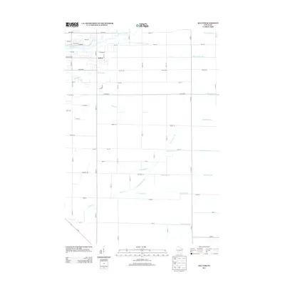
2013 Map of Kellner
USGS Topo · Published 2013About this map
Kellner sits at the heart of a highly engineered Wisconsin landscape, where the natural hydrology of the Central Sands region has been extensively altered for agriculture. The settlement is surrounded by a dense grid of numbered drainage canals, including Ditch Number Three, Ditch Number Five, and Ditch Number Ten, which cut across the terrain to manage the water table. This intricate system of artificial waterways, like Lateral Number Two, works alongside named natural drainages such as Sevenmile Cr and Fivemile Cr. To the northwest, the reservoir of Wazeecha Lake 100 serves as a local landmark, fed by Buena Vista Creek. The regular orientation of roads like Griffith Ave and 80th St S reflects the township-and-range surveying that defines this part of Wood County, supporting a landscape of productive fields and rural residences.
Find a feature on this map
56 named features on this map. Tap any name to fly to it.
Don’t see what you’re looking for? This feature index may not catch every label — zoom into the map to look around manually.
Map Details
Editions of this 2013 Kellner Map
This is the sole edition of this map. No revisions or reprints were ever made.
Other maps of this area

1955 · Green Bay
USGS Topo · 1:250,000

1957 · Wisconsin Rapids
USGS Topo · 1:48,000

1957 · Whiting
USGS Topo · 1:48,000

1958 · Arkdale
USGS Topo · 1:48,000

1958 · Coloma
USGS Topo · 1:48,000

1967 · Arkdale NE
USGS Topo · 1:24,000

1967 · Wisconsin Rapids
USGS Topo · 1:62,500

1968 · Coloma NW
USGS Topo · 1:24,000

1968 · Hancock
USGS Topo · 1:24,000

1970 · Kellner
USGS Topo · 1:24,000