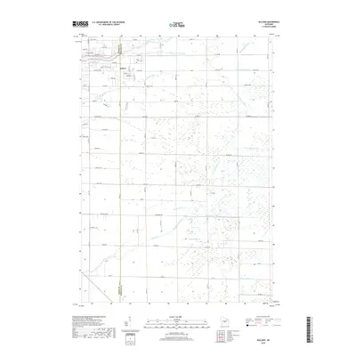
2018 Map of Kellner
USGS Topo · Published 2018About this map
Kellner sits at the intersection of the Wood and Portage county line, serving as a central point for this agricultural and woodland landscape. The area is defined by an extensive network of drainage infrastructure, including Ditch Number Three, Ditch Number Four, and Lateral Number Two, which manage the water table across the low-lying terrain. Local genealogy is anchored by Saint Johns Cem near the town center, while recreational and natural features such as Wazeecha Lake and the winding Bloody Run provide a contrast to the straight-line grid of the county roads. The southern portion of the map is dominated by the seasonal flows of Sevenmile Cr and Tenmile Cr, illustrating the complex hydrology of the central Wisconsin sand plain.
Find a feature on this map
56 named features on this map. Tap any name to fly to it.
Don’t see what you’re looking for? This feature index may not catch every label — zoom into the map to look around manually.
Map Details
Editions of this 2018 Kellner Map
This is the sole edition of this map. No revisions or reprints were ever made.
Other maps of this area

1955 · Green Bay
USGS Topo · 1:250,000

1957 · Wisconsin Rapids
USGS Topo · 1:48,000

1957 · Whiting
USGS Topo · 1:48,000

1958 · Arkdale
USGS Topo · 1:48,000

1958 · Coloma
USGS Topo · 1:48,000

1967 · Arkdale NE
USGS Topo · 1:24,000

1967 · Wisconsin Rapids
USGS Topo · 1:62,500

1968 · Coloma NW
USGS Topo · 1:24,000

1968 · Hancock
USGS Topo · 1:24,000

1970 · Kellner
USGS Topo · 1:24,000