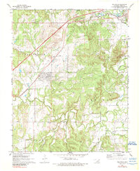
1972 Map of Kellyville
USGS Topo · Published 1989About this map
The Oklahoma oil economy and local transit networks are clearly visible in this 1970s survey. The town of Kellyville serves as a central hub, situated near the St Louis-San Francisco railroad and the Turner Toll Road. The landscape is densely marked by the petroleum industry, featuring numerous Oil Wells and a sprawling Oil Field that spans the hills between Kellyville and Sapulpa.
Find a feature on this map
27 named features on this map. Tap any name to fly to it.
Don’t see what you’re looking for? This feature index may not catch every label — zoom into the map to look around manually.
Map Details
Editions of this 1972 Kellyville Map
2 editions found
Other maps of this area

1901 · Nuyaka
USGS Topo · 1:125,000

1912 · Hominy
USGS Topo · 1:125,000

1914 · Kiefer
USGS Topo · 1:62,500

1915 · Hominy
USGS Topo · 1:125,000

1916 · Kiefer
USGS Topo · 1:62,500

1916 · Bristow
USGS Topo · 1:62,500

1954 · Oklahoma City
USGS Topo · 1:250,000

1955 · Enid
USGS Topo · 1:250,000

1956 · Sapulpa North
USGS Topo · 1:24,000

1957 · Oklahoma City
USGS Topo · 1:250,000