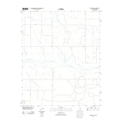
2012 Map of Kelton SE
USGS Topo · Published 2012About this map
The N Fork Red River meanders through this landscape on the Texas-Oklahoma border, defining the central geography of the quadrangle. North of the river, the terrain is shaped by the drainage of Salt Cr and a rigid grid of rural transport routes. This 2012 survey reveals a transition from the structured farm-to-market roads like Fm-592 and Fm-2299 to more localized county connectors. The network of paths, such as Co Road R, Co Rd 25, and Co Road T, reflects a highly organized agricultural land division typical of the High Plains. To the southeast, the numbering shifts to the Oklahoma-style E1200 Rd, marking the subtle administrative boundary shifts between states and counties in this sparsely populated region.
Find a feature on this map
17 named features on this map. Tap any name to fly to it.
Don’t see what you’re looking for? This feature index may not catch every label — zoom into the map to look around manually.
Map Details
Editions of this 2012 Kelton SE Map
This is the sole edition of this map. No revisions or reprints were ever made.
Other maps of this area

1954 · Amarillo
USGS Topo · 1:250,000

1955 · Clinton
USGS Topo · 1:250,000

1957 · Clinton
USGS Topo · 1:250,000

1958 · Amarillo
USGS Topo · 1:250,000

1960 · Sweetwater
USGS Topo · 1:62,500

1961 · Erick
USGS Topo · 1:62,500

1962 · Twitty
USGS Topo · 1:24,000

1962 · Kelton SE
USGS Topo · 1:24,000

1963 · Kelton
USGS Topo · 1:24,000

1963 · Kelton NW
USGS Topo · 1:24,000