
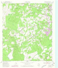
1949 Map of Keltys
USGS Topo · Published 1977About this map
The timber and transit landscape of Angelina County is captured here in the late 1940s, anchored by the company-town character of Keltys and the expanding northwestern boundary of Lufkin. This era shows a transition from rural homesteads to industrial corridors, where the Texas South-Eastern RR and the Southern Pacific RR create a dense rail network supporting local commerce. Settlement patterns follow these tracks and the many local creeks, such as Kurkindall Creek and Jack Creek, with community life centered around small institutions like the Mabel Melear Sch and Bethlehem Ch.
Find a feature on this map
43 named features on this map. Tap any name to fly to it.
Don’t see what you’re looking for? This feature index may not catch every label — zoom into the map to look around manually.
Map Details
Editions of this 1949 Keltys Map
2 editions found
Other maps of this area

1932 · Manning
USGS Topo · 1:62,500

1949 · Lufkin
USGS Topo · 1:62,500

1949 · Clawson
USGS Topo · 1:24,000

1949 · Lufkin
USGS Topo · 1:24,000

1950 · Keltys
USGS Topo · 1:24,000

1950 · Lufkin
USGS Topo · 1:24,000

1950 · Clawson
USGS Topo · 1:24,000

1950 · Redland
USGS Topo · 1:24,000

1951 · Wells
USGS Topo · 1:24,000

1951 · Wells SW
USGS Topo · 1:24,000