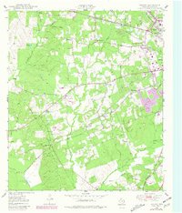
1949 Map of Keltys
USGS Topo · Published 1981About this map
The timber and transit landscape of Angelina County comes into focus on this 1949 survey, centered on the community of Keltys. Situated just northwest of Lufkin, this area was a hub of rail activity where the St Louis Southwestern RR and the Texas South-Eastern RR converge. The rural character of the era is preserved through numerous family-named landmarks and institutions, such as the Mabel Melear Sch and the Agricultural Experiment Station. To the west, the map details the terrain around Walker Lake and the winding course of Largent Creek. Small settlements and social centers are frequent, including Providence, Peavy, and Granville, alongside several country houses of worship like Bethlehem Ch and New Hope Ch. The document also captures 1980s updates in purple, showing the expansion of residential and commercial development near the Lufkin corporate boundary.
Find a feature on this map
43 named features on this map. Tap any name to fly to it.
Don’t see what you’re looking for? This feature index may not catch every label — zoom into the map to look around manually.
Map Details
Editions of this 1949 Keltys Map
2 editions found
Other maps of this area

1932 · Manning
USGS Topo · 1:62,500

1949 · Lufkin
USGS Topo · 1:62,500

1949 · Clawson
USGS Topo · 1:24,000

1949 · Lufkin
USGS Topo · 1:24,000

1949 · Keltys
USGS Topo · 1:24,000

1950 · Keltys
USGS Topo · 1:24,000

1950 · Lufkin
USGS Topo · 1:24,000

1950 · Clawson
USGS Topo · 1:24,000

1950 · Redland
USGS Topo · 1:24,000

1951 · Wells
USGS Topo · 1:24,000