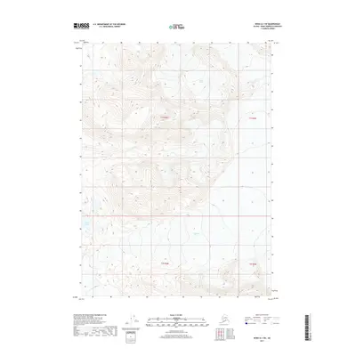
2017 Map of Kenai A-1 SW
USGS Topo · Published 2017About this map
Tustumena Glacier and Indian Glacier dominate this high-elevation Alaskan terrain within the Kenai Peninsula Borough. The landscape is defined by massive ice fields and the deep glacial valleys they carve, revealing the slow geological movement characteristic of this subarctic environment. Aside from these frozen giants, the area features Sheep Lake, a isolated body of water positioned in the southwest. The lack of roads, settlements, or structures across the townships of t1s r6w and t2s r6w highlights the untouched nature of this wilderness. This survey is a record of pure topography, focusing on the relationship between permanent ice and the high ridges of the Kenai mountains.
Find a feature on this map
9 named features on this map. Tap any name to fly to it.
Don’t see what you’re looking for? This feature index may not catch every label — zoom into the map to look around manually.
Map Details
Editions of this 2017 Kenai A-1 SW Map
This is the sole edition of this map. No revisions or reprints were ever made.
Other maps of this area

1944 · Kenai
USGS Topo · 1:250,000

1950 · Kenai
USGS Topo · 1:250,000

1950 · Seldovia D-2
USGS Topo · 1:63,360

1951 · Seldovia
USGS Topo · 1:250,000

1951 · Kenai A-2
USGS Topo · 1:63,360

1951 · Kenai A-1
USGS Topo · 1:63,360

1951 · Seldovia D-1
USGS Topo · 1:63,360

1952 · Kenai A-1
USGS Topo · 1:63,360

1952 · Kenai A-2
USGS Topo · 1:63,360

1953 · Seldovia D-2
USGS Topo · 1:63,360