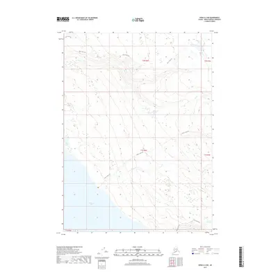
2017 Map of Kenai A-2 NW
USGS Topo · Published 2017About this map
Tustumena Lake defines the southwestern corner of this topographical survey, which covers a portion of the Kenai Peninsula. The landscape is characterized by a network of drainage systems including Bear Cr, Moose Cr, and Indian Cr that carve through the rising elevation. Travel and exploration through this wilderness are marked by established routes such as the Bear Creek Trail in the north and the Moose Creek Trail which spans the central and southern sections. Small, isolated bodies of water are scattered across the terrain, including Wolverine Lake, Timberline Lake, and Point Lake. In the far southeast, the Emma Lake Trail provides access toward Lake Emma, illustrating the limited but critical human infrastructure present in this remote Alaskan environment.
Find a feature on this map
16 named features on this map. Tap any name to fly to it.
Don’t see what you’re looking for? This feature index may not catch every label — zoom into the map to look around manually.
Map Details
Editions of this 2017 Kenai A-2 NW Map
This is the sole edition of this map. No revisions or reprints were ever made.
Other maps of this area

1944 · Kenai
USGS Topo · 1:250,000

1950 · Kenai
USGS Topo · 1:250,000

1950 · Kenai B-3
USGS Topo · 1:63,360

1951 · Kenai B-2
USGS Topo · 1:63,360

1951 · Kenai A-3
USGS Topo · 1:63,360

1951 · Kenai A-2
USGS Topo · 1:63,360

1952 · Kenai B-3
USGS Topo · 1:63,360

1952 · Kenai B-2
USGS Topo · 1:63,360

1952 · Kenai A-2
USGS Topo · 1:63,360

1952 · Kenai A-3
USGS Topo · 1:63,360