
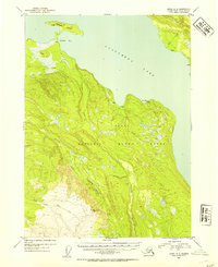
1952 Map of Kenai A-3
USGS Topo · Published 1954About this map
Tustumena Lake dominates the northern reaches of this mid-century survey, its expansive waters meeting the protected wilderness of the Kenai National Moose Range. The shoreline is defined by geographical landmarks such as Nikolai Bay and the sheltering landmass of Caribou Island. In this era, human activity is marked only by isolated Cabin and Cabins labels, indicating a landscape defined by seasonal habitation, trapping, or early conservation efforts rather than established towns.
Find a feature on this map
13 named features on this map. Tap any name to fly to it.
Don’t see what you’re looking for? This feature index may not catch every label — zoom into the map to look around manually.
Map Details
Editions of this 1952 Kenai A-3 Map
2 editions found
Other maps of this area

1944 · Kenai
USGS Topo · 1:250,000

1949 · Seldovia D-4
USGS Topo · 1:63,360

1950 · Kenai
USGS Topo · 1:250,000

1950 · Seldovia D-2
USGS Topo · 1:63,360

1950 · Kenai B-3
USGS Topo · 1:63,360

1951 · Seldovia D-4
USGS Topo · 1:63,360

1951 · Seldovia
USGS Topo · 1:250,000

1951 · Seldovia D-3
USGS Topo · 1:63,360

1951 · Kenai B-2
USGS Topo · 1:63,360

1951 · Kenai A-3
USGS Topo · 1:63,360