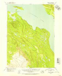
1952 Map of Kenai A-3
USGS Topo · Published 1954About this map
Tustumena Lake dominates the upper half of this 1950s survey, its waters reaching into Nikolai Bay and Big Bay along the north-central shore. The landscape is characterized by the expansive Kenai National Moose Range, which encompasses a complex network of waterways including Nikolai Creek, Crooked Creek, and the North Fork Deep Creek. Isolated Cabin and Cabins labels are scattered along the shoreline of Caribou Island and near the mouths of creeks like Bear Creek, indicating the presence of seasonal dwellings or remote outposts in this wilderness area during the early 1950s. The topography transitions from the low-lying lake margins to the rising elevations along the Approximate Boundary in the south, where the drainage systems of Fox Creek and other smaller tributaries begin their descent toward the lake.
Find a feature on this map
13 named features on this map. Tap any name to fly to it.
Don’t see what you’re looking for? This feature index may not catch every label — zoom into the map to look around manually.
Map Details
Editions of this 1952 Kenai A-3 Map
2 editions found

Other maps of this area

1944 · Kenai
USGS Topo · 1:250,000

1949 · Seldovia D-4
USGS Topo · 1:63,360

1950 · Kenai
USGS Topo · 1:250,000

1950 · Seldovia D-2
USGS Topo · 1:63,360

1950 · Kenai B-3
USGS Topo · 1:63,360

1951 · Seldovia D-4
USGS Topo · 1:63,360

1951 · Seldovia
USGS Topo · 1:250,000

1951 · Seldovia D-3
USGS Topo · 1:63,360

1951 · Kenai B-2
USGS Topo · 1:63,360

1951 · Kenai A-3
USGS Topo · 1:63,360