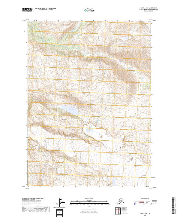
2024 Map of Kenai A-2 SE
USGS Topo · Published 2024About this map
The Kenai Wilderness (Andrew Simons Unit) dominates this remote landscape on the Kenai Peninsula, preserved within the broader Kenai National Wildlife Refuge. This modern topographic survey highlights a high-altitude wilderness defined by its significant hydrography, where Indian Creek flows through the northern reaches near Goldeneye Lake. The southern terrain is anchored by larger water bodies like Arctic Lake and Green Lake, situated in the valley bottoms between steep interior ridges. These basins reflect the typical glacial-carved topography of the Alaskan interior, where drainage patterns like Trout Creek illustrate the natural runoff from the surrounding peaks. This map serves as an essential record of the protected wilderness boundaries and the pristine hydrology of the peninsula's mountainous core.
Find a feature on this map
12 named features on this map. Tap any name to fly to it.
Don’t see what you’re looking for? This feature index may not catch every label — zoom into the map to look around manually.
Map Details
Editions of this 2024 Kenai A-2 SE Map
This is the sole edition of this map. No revisions or reprints were ever made.
Other maps of this area

1944 · Kenai
USGS Topo · 1:250,000

1950 · Kenai
USGS Topo · 1:250,000

1950 · Seldovia D-2
USGS Topo · 1:63,360

1951 · Seldovia
USGS Topo · 1:250,000

1951 · Kenai A-2
USGS Topo · 1:63,360

1951 · Kenai A-1
USGS Topo · 1:63,360

1951 · Seldovia D-1
USGS Topo · 1:63,360

1952 · Kenai A-1
USGS Topo · 1:63,360

1952 · Kenai A-2
USGS Topo · 1:63,360

1953 · Seldovia D-2
USGS Topo · 1:63,360