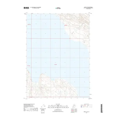
2017 Map of Kenai A-3 NE
USGS Topo · Published 2017About this map
Tustumena Lake dominates this glacial landscape on the Kenai Peninsula, where the water's edge meets the rising topography of the Kenai Mountains. The map illustrates the wilderness interface between the lake and the upland terrain, particularly around the southern indentations of Big Bay. To the northeast, the Bear Creek Trail provides a route through the drainage of Bear Cr, tracing the natural contours of the land. In the southern portion of the sheet, Fox Cr flows through the township of T1S R10W, illustrating the remote drainage patterns of the region. The map captures the Peninsula's character before modern encroachment, focusing on the essential water bodies and trails that define the local geography.
Find a feature on this map
10 named features on this map. Tap any name to fly to it.
Don’t see what you’re looking for? This feature index may not catch every label — zoom into the map to look around manually.
Map Details
Editions of this 2017 Kenai A-3 NE Map
This is the sole edition of this map. No revisions or reprints were ever made.
Other maps of this area

1944 · Kenai
USGS Topo · 1:250,000

1950 · Kenai
USGS Topo · 1:250,000

1950 · Kenai B-3
USGS Topo · 1:63,360

1951 · Kenai B-2
USGS Topo · 1:63,360

1951 · Kenai A-3
USGS Topo · 1:63,360

1951 · Kenai A-2
USGS Topo · 1:63,360

1952 · Kenai B-3
USGS Topo · 1:63,360

1952 · Kenai B-2
USGS Topo · 1:63,360

1952 · Kenai A-2
USGS Topo · 1:63,360

1952 · Kenai A-3
USGS Topo · 1:63,360