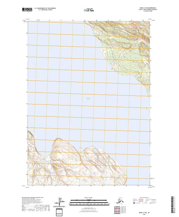
2024 Map of Kenai A-3 NE
USGS Topo · Published 2024About this map
Kenai National Wildlife Refuge dominates this section of the Kenai Peninsula, showcasing the transition from deep glacial waters to the surrounding wilderness. The map is centered on the expansive Tustumena Lake, where the shoreline reaches into Big Bay at the southern edge. The northern landscape is defined by the Kenai Wilderness (Andrew Simons Unit), a protected area where high-elevation contours fall toward the water's edge. Access into this interior is marked by the Bear Creek Tr, which follows the drainage of Bear Creek as it flows from the northeast. Further west, Fox Creek carves through the terrain, illustrating the hydrologic network that feeds into one of Alaska's largest freshwater systems. This 2024 survey provides a modern view of the preservation boundaries and natural drainage patterns within the Kenai Peninsula Borough.
Find a feature on this map
12 named features on this map. Tap any name to fly to it.
Don’t see what you’re looking for? This feature index may not catch every label — zoom into the map to look around manually.
Map Details
Editions of this 2024 Kenai A-3 NE Map
This is the sole edition of this map. No revisions or reprints were ever made.
Other maps of this area

1944 · Kenai
USGS Topo · 1:250,000

1950 · Kenai
USGS Topo · 1:250,000

1950 · Kenai B-3
USGS Topo · 1:63,360

1951 · Kenai B-2
USGS Topo · 1:63,360

1951 · Kenai A-3
USGS Topo · 1:63,360

1951 · Kenai A-2
USGS Topo · 1:63,360

1952 · Kenai B-3
USGS Topo · 1:63,360

1952 · Kenai B-2
USGS Topo · 1:63,360

1952 · Kenai A-2
USGS Topo · 1:63,360

1952 · Kenai A-3
USGS Topo · 1:63,360