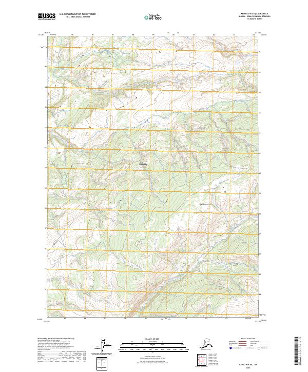
2024 Map of Kenai A-4 SE
USGS Topo · Published 2024About this map
The Ninilchik region on the Kenai Peninsula reveals a landscape defined by the gradual ascent from the coast toward the interior uplands. The drainage of North Fork Deep Creek carves a path through the southeastern portion of the quadrangle, illustrating the complex hydrology of the Alaskan wilderness. The presence of Oil Well Road in the southwest corner signals the intersection of resource extraction and infrastructure in this remote coastal district, providing a clear reference point for tracing the history of local development and land use. Surveyed with twenty-foot contour intervals, this topographical study captures the subtle transitions between forested slopes and the winding riparian corridors that define the Kenai interior.
Find a feature on this map
8 named features on this map. Tap any name to fly to it.
Don’t see what you’re looking for? This feature index may not catch every label — zoom into the map to look around manually.
Map Details
Editions of this 2024 Kenai A-4 SE Map
This is the sole edition of this map. No revisions or reprints were ever made.
Other maps of this area

1944 · Kenai
USGS Topo · 1:250,000

1949 · Seldovia D-4
USGS Topo · 1:63,360

1950 · Kenai
USGS Topo · 1:250,000

1951 · Seldovia D-4
USGS Topo · 1:63,360

1951 · Seldovia
USGS Topo · 1:250,000

1951 · Seldovia D-3
USGS Topo · 1:63,360

1951 · Kenai A-3
USGS Topo · 1:63,360

1951 · Kenai A-4
USGS Topo · 1:63,360

1952 · Kenai A-3
USGS Topo · 1:63,360

1952 · Kenai A-4
USGS Topo · 1:63,360